Le contenu de Alexhike a été migré vers Hikster
NOUVEAU
Prolongez le souvenir de vos randonnées d'exceptionNous transformons votre aventure en une carte 3D Haute-Définition
 En savoir plus
Distances et altitudes
Type
BoucleDistance
4.38kmElevation +
106 mElevation -
-106 mPoint le + haut
94 mPoint le + bas
38 mActivités
| Activité | Durée estimée | Difficulté |
|---|---|---|
| Rando | 0h30 | Débutant |
| Raquette | 0h45 | Débutant |
| Randonnée hivernale | 0h30 | Débutant |
Météo
Voir la météo complète : Température, vent, pluie, neige, …. Et même les caméras à proximité
A propos
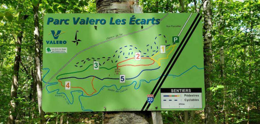
Le parc comporte 5 tronçons.
Cette boucle débute par le sentier 1, 2, 3 puis 4.
Le retour se fait par le sentier 5 puis 1.
Les sentiers sont très bien balisés et les panneaux d'indication faciles à lire.
Voir la page de description: PARC VALÉRO - LES ÉCARTS
pour y trouver les horaires d'ouverture, tarifs, régles de vie et les autres sentiers disponibles.
Hébergements à proximité
Galerie d'images