Le contenu de Alexhike a été migré vers Hikster
NOUVEAU
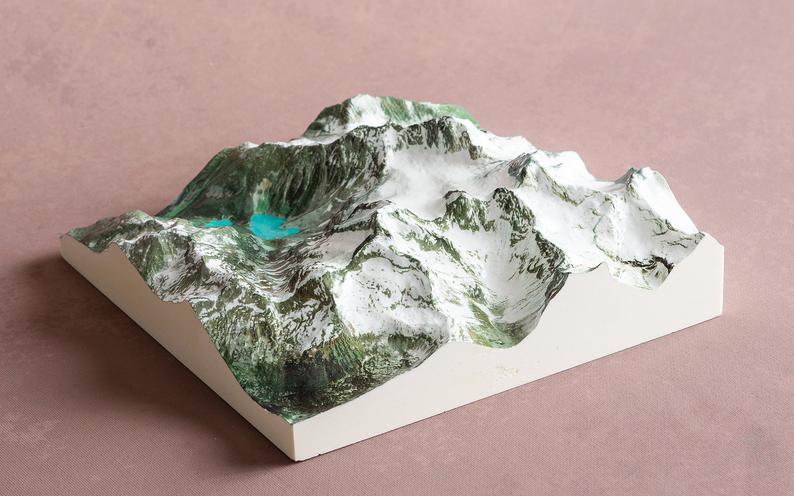
Prolongez le souvenir de vos randonnées d'exceptionNous transformons votre aventure en une carte 3D Haute-Définition
 En savoir plus
Distances et altitudes
Type
BoucleDistance
13.05kmElevation +
-Elevation -
-Point le + haut
-Point le + bas
-Activités
| Activité | Durée estimée | Difficulté |
|---|---|---|
| Rando | 5h15 | Intermédiaire |
Météo
Voir la météo complète : Température, vent, pluie, neige, …. Et même les caméras à proximité
A propos
Vous cherchez une excursion pour la journée? Vous désirez marcher et vous éloigner de l’action? Optez pour le sentier du Malard. À travers un dénivelé total de 280 m, attardez-vous aux indices d’activités de la faune : aux abords du lac Malard, sur les collines couvertes d’érablière, parmi les conifères des rives des ruisseaux. Cassez la croûte à la Ouache. Bien que ce refuge porte le nom de l’abri de l’ours, n’ayez crainte − aucun ours noir ne vous y attendra!Voir la page de description: PARC NATIONAL DU MONT-TREMBLANT
pour y trouver les horaires d'ouverture, tarifs, régles de vie et les autres sentiers disponibles.